Welcome, dear readers! After months of immersive research into Nigeria’s federal structure, countless consultations with constitutional experts from Abuja to Lagos, and years of documenting how our administrative divisions shape Nigerian identity, I’m absolutely thrilled to share this comprehensive guide with you. Understanding Nigeria’s states isn’t merely an academic exercise in geography. Rather, it’s a window into how our federation operates, how power distributes across our vast territory, and how our diverse peoples organise themselves politically. The question “how many states are there in Nigeria?” reveals layers of constitutional history, ethnic accommodation, and administrative evolution that define modern Nigeria.
Nigeria operates with 36 states plus the Federal Capital Territory (FCT), Abuja, creating a federal structure that attempts to balance ethnic diversity, resource distribution, and political representation across our 923,768 square kilometres. This structure emerged from decades of state creation exercises beginning in 1967 when General Yakubu Gowon divided the original four regions into 12 states, continuing through multiple military regimes until reaching the current 36-state configuration in 1996 when General Sani Abacha created Bayelsa, Ebonyi, Ekiti, Gombe, Nasarawa, and Zamfara states. The 1999 Constitution formally enshrines these 36 states by name in Section 3(1), establishing the constitutional framework that governs our federal system to this day.
I still remember my confusion as a child when my father explained that Nigeria hadn’t always had 36 states. “How could states just appear?” I asked, imagining them rising from the earth like new islands. He laughed and pulled out an old atlas showing only 12 states.
That moment sparked my lifelong fascination with Nigeria’s administrative evolution.
What Are the 36 States of Nigeria?
The complete list of Nigeria’s 36 states, as enshrined in the Constitution of the Federal Republic of Nigeria, includes Abia, Adamawa, Akwa Ibom, Anambra, Bauchi, Bayelsa, Benue, Borno, Cross River, Delta, Ebonyi, Edo, Ekiti, Enugu, Gombe, Imo, Jigawa, Kaduna, Kano, Katsina, Kebbi, Kogi, Kwara, Lagos, Nasarawa, Niger, Ogun, Ondo, Osun, Oyo, Plateau, Rivers, Sokoto, Taraba, Yobe, and Zamfara. These states distribute across six geopolitical zones (North West, North East, North Central, South West, South East, and South South) that informally structure Nigerian politics, federal appointments, and resource allocation formulas.
Each state possesses its own governor, state assembly, and administrative apparatus operating under the constitutional framework that divides powers between federal and state governments. According to the Federal Capital Territory Administration, the FCT occupies a unique position as neither a state nor under state governance, instead functioning under direct federal administration whilst enjoying many state-like provisions under Section 299 of the Constitution.
The distribution reflects deliberate efforts to accommodate Nigeria’s extraordinary ethnic diversity. When you examine the state structure closely, you notice patterns rather like geological strata revealing historical pressures.
Northern states tend to be geographically larger but less densely populated than southern counterparts. Kano State houses over 15 million people in 20,131 square kilometres, whilst Niger State spreads only 5 million across 76,363 square kilometres. This disparity creates interesting governance challenges where population density, resource availability, and administrative capacity vary wildly across states.
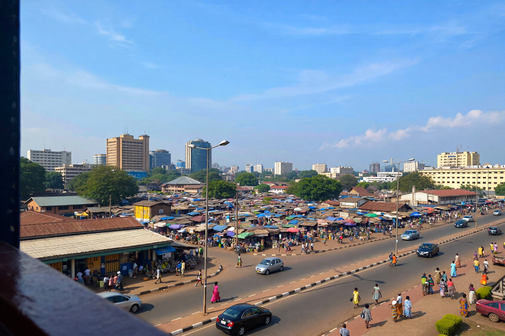
I spent three months in 2023 travelling through all six geopolitical zones, visiting at least one state in each region. The differences astounded me. In Kano, I witnessed an emirate system where traditional rulers wield enormous social influence alongside elected officials. In Rivers State, I observed oil wealth creating infrastructure that made Port Harcourt feel rather like a different country from rural Sokoto. Yet all operate under the same constitutional framework, which speaks to both the flexibility and the tensions within Nigerian federalism.
Understanding Nigeria’s Federal Structure Through Seven Key Steps
Grasping Nigeria’s state system requires moving beyond simple memorisation of names to understanding the historical, political, and ethnic calculations that produced our current structure. Here’s how to develop comprehensive understanding:
1. Master the Constitutional Foundation
Start with Section 3 of the 1999 Constitution, which explicitly lists all 36 states and defines the Federal Capital Territory. Understanding this constitutional basis matters because it establishes that states cannot be created, merged, or abolished without constitutional amendment, which requires two-thirds approval from both houses of the National Assembly plus consent from at least two-thirds of state Houses of Assembly. This rigorous process explains why despite constant agitation for new states from various quarters, Nigeria hasn’t created additional states since 1996. The constitutional entrenchment protects existing states from arbitrary dissolution whilst making state creation extremely difficult politically.
2. Study the Historical Evolution From Four Regions to 36 States
Nigeria began independence in 1960 with three regions (Northern, Eastern, and Western), expanded to four with the Mid-Western Region in 1963, jumped to 12 states in 1967, grew to 19 states in 1976, expanded to 21 states in 1987, reached 30 states in 1991, and finally achieved 36 states in 1996. Each creation exercise responded to specific political pressures, ethnic agitations, or administrative considerations. The 1967 state creation deliberately broke up the powerful regions to weaken separatist sentiments during the civil war period. The 1976 exercise under Murtala Mohammed attempted to create more balanced federating units. Subsequent creations largely accommodated ethnic minority demands for political recognition and access to federal resources.
Understanding this history reveals that state creation wasn’t a rational administrative planning exercise. It was political negotiation, military fiat, and ethnic accommodation rolled into one messy process. That explains why we have states with vastly different populations, resources, and capacities.
3. Learn the Geographic Distribution Across Six Geopolitical Zones
Nigeria’s six geopolitical zones provide an informal but politically crucial framework for understanding state distribution. The North West comprises Jigawa, Kaduna, Kano, Katsina, Kebbi, Sokoto, and Zamfara states. The North East includes Adamawa, Bauchi, Borno, Gombe, Taraba, and Yobe states. The North Central zone encompasses Benue, Kogi, Kwara, Nasarawa, Niger, and Plateau states plus the FCT. The South West consists of Ekiti, Lagos, Ogun, Ondo, Osun, and Oyo states. The South East comprises Abia, Anambra, Ebonyi, Enugu, and Imo states. The South South includes Akwa Ibom, Bayelsa, Cross River, Delta, Edo, and Rivers states.
These zones aren’t constitutionally recognised but shape Nigerian politics profoundly. Federal appointments often aim for “geopolitical balance” with each zone expecting representation in cabinet positions, federal agencies, and security appointments. Resource allocation formulas sometimes incorporate zonal considerations. Presidential candidates strategise about zonal support bases. I’ve watched political negotiations where “we need someone from the South East” or “the North Central zone deserves this position” determined outcomes regardless of individual merit.
4. Understand State Creation Criteria and Why New States Remain Unlikely
The Constitution outlines specific procedures for state creation in Section 8, requiring a request supported by at least two-thirds of members representing the area demanding statehood in each local government council involved, approval by at least two-thirds of all local government councils in that area, a request by two-thirds of members in the Houses of Assembly affected, approval by a simple majority in a referendum of people in the area, and approval by a resolution passed by two-thirds majority in each house of the National Assembly. Additionally, the National Assembly must be satisfied that the proposed state is viable economically, has sufficient population and land area, and wouldn’t adversely affect other states.
These stringent requirements make new state creation extraordinarily difficult. Currently, numerous groups agitate for additional states including demands for Anioma State from Delta, Etiti State from the South East, Aba State from Abia, Kainji State from Niger/Kebbi, and dozens more. Despite regular bills in the National Assembly proposing new states, none have succeeded since 1996 because achieving the required supermajorities proves nearly impossible when existing states fear losing territory, resources, or political influence.
5. Recognise That State Governments Exercise Limited Autonomy
Nigeria’s federalism concentrates enormous power at the federal level through the Exclusive Legislative List, which reserves key areas like defence, foreign affairs, currency, telecommunications, aviation, railways, and petroleum to federal control. States control agriculture, markets, culture, traditional matters, and local government, but depend heavily on monthly federal allocations for funding since most states generate insufficient internal revenue. According to Guardian Nigeria’s analysis of devolution, recent constitutional amendments have shifted railways and electricity to the Concurrent List, allowing states greater involvement, but fundamental fiscal dependency persists.
I witnessed this dependency firsthand when researching state budgets in 2024. Many states derive over 70 per cent of their revenue from federal allocations drawn from the Federation Account. Only Lagos State generates internal revenue exceeding federal allocations, making it uniquely autonomous financially. This dependency means states exercise theoretical powers but face practical constraints when federal allocations delay or diminish. The system creates rather like feudal vassals whose autonomy depends on the centre’s generosity.
6. Appreciate How Ethnic Considerations Drive State Distribution
Nearly every state creation exercise since 1967 responded partly to ethnic minority demands for political recognition. The original regions concentrated power among the three major groups (Hausa-Fulani in the North, Yoruba in the West, Igbo in the East) whilst marginalising hundreds of minority groups. State creation allowed minority groups to achieve political representation and access federal resources through governorships, senate seats, and ministerial appointments tied to state identity. As noted in Guardian Nigeria’s examination of federalism, the 36-state structure attempts to balance ethnic representation whilst creating administratively viable units.
Examining state boundaries reveals ethnic calculations. Akwa Ibom State separated from Cross River State in 1987 largely to give the Ibibio/Annang people their own state. Ebonyi State emerged in 1996 to unite various Igbo groups previously divided among Abia, Enugu, and Cross River states. Kebbi State separated from Sokoto in 1991 partly along ethnic lines between Hausa and Fulani populations. These ethnic considerations sometimes override administrative logic, creating states with questionable economic viability but clear ethnic constituencies.
7. Study Current Debates About Restructuring and State Viability
Contemporary Nigerian political discourse features intense debates about whether 36 states represent too many, too few, or the wrong configuration entirely. Some commentators, including Guardian Nigeria’s analysis of Nigeria’s federal structure, argue that 36 states fragment Nigeria excessively, creating expensive bureaucracies that most states cannot afford without federal subsidies. They advocate returning to regional structures or reducing to perhaps 12 to 18 economically viable states.
Others argue Nigeria needs additional states to accommodate ethnic groups still feeling marginalised, particularly in the South East which has only five states compared to seven in the North West. Still others propose maintaining 36 states whilst devolving more powers and resources to enable genuine state autonomy. These debates reveal fundamental questions about Nigerian federalism: Should states be administrative units of federal government or autonomous federating units? Should ethnic representation or economic viability determine state creation? How do we balance the competing demands of over 371 ethnic groups within any state structure?
I’ve attended numerous conferences where these debates rage between proponents of regional government, defenders of the 36-state structure, and advocates for further state creation. Nobody has found solutions that satisfy all constituencies. That’s rather the story of Nigerian federalism.
What Is the Biggest State in Nigeria?
Niger State holds the distinction as Nigeria’s largest state by land area, covering 76,363 square kilometres of territory across the North Central geopolitical zone. This makes Niger State larger than entire countries including Togo (56,785 sq km), Sierra Leone (71,740 sq km), and slightly smaller than Sierra Leone and Belgium combined. The state stretches from the Niger River in the south to the borders with Benin Republic and Niger Republic in the north and west, encompassing diverse terrain including savannah grasslands, river valleys, rocky outcrops around Minna and Bida, and agricultural zones producing rice, sorghum, millet, and groundnuts.
Despite its vast size, Niger State houses only approximately 5.5 million people according to recent estimates, giving it one of Nigeria’s lowest population densities at roughly 72 people per square kilometre compared to Lagos State’s estimated 2,700 people per square kilometre. This creates interesting administrative challenges where governance must extend across enormous distances to reach scattered populations in remote areas.
The state capital, Minna, sits roughly at the centre of the state, approximately 150 kilometres from Abuja. Niger State’s strategic location explains its name, derived from the mighty Niger River that flows through it, and its continued importance to national hydroelectric power generation through the Kainji, Jebba, and Shiroro dams that collectively provide substantial portions of Nigeria’s electricity.
I visited Niger State in 2022, driving from Minna to Kontagora and then to Bida. The distances astounded me. We drove for hours through landscapes that seemed to stretch endlessly, passing small villages every 30 to 40 kilometres. The deputy governor I interviewed explained that providing basic services (schools, health centres, roads) across such vast territory consumed enormous resources whilst the state’s relatively small population limited revenue generation. “We’re land-rich but cash-poor,” he said, rather capturing the paradox of Nigeria’s largest state.
Following Niger State in land area, the next largest states include Borno State (70,898 sq km) in the North East, Taraba State (54,473 sq km) also in the North East, Kaduna State (46,053 sq km) in the North West, and Bauchi State (45,893 sq km) in the North East. These five states collectively control roughly 40 per cent of Nigeria’s total land area, illustrating how Nigeria’s geography concentrates in the north whilst southern states occupy smaller, more densely populated territories.
Geographic Comparison of Nigeria’s Largest States
| State | Land Area (sq km) | Population (million) | Population Density (per sq km) | Geopolitical Zone | State Capital | Primary Economic Activities |
|---|---|---|---|---|---|---|
| Niger | 76,363 | 5.5 | 72 | North Central | Minna | Agriculture, hydroelectric power, rice production |
| Borno | 70,898 | 5.8 | 82 | North East | Maiduguri | Agriculture, livestock, fishing (Lake Chad) |
| Taraba | 54,473 | 3.2 | 59 | North East | Jalingo | Agriculture, cattle rearing, tourism (Mambilla Plateau) |
| Kaduna | 46,053 | 8.2 | 178 | North West | Kaduna | Manufacturing, agriculture, services |
| Bauchi | 45,893 | 6.5 | 142 | North East | Bauchi | Agriculture, mining, trade |
Nigeria’s largest states concentrate overwhelmingly in the northern regions where historical factors including pre-colonial kingdoms with vast territorial claims, lower population densities enabling larger administrative units, and military regimes favouring northern interests during state creation exercises produced geographically massive states. Southern states, by contrast, developed in more densely populated coastal and forest zones where ethnic groups occupied smaller territories, creating states like Lagos (3,577 sq km) and Anambra (4,844 sq km) that pack enormous populations into limited space.
This north-south divide in state sizes creates policy challenges around revenue allocation. Should states receive allocations based on population, land area, or some combination? Should massive but sparsely populated states receive less than tiny but densely populated states? These questions drive endless political debates where northern states argue land area creates infrastructure costs whilst southern states argue population creates service demands.
Which State Is the Richest in Nigeria?
Lagos State unquestionably holds the title as Nigeria’s wealthiest state by virtually every economic metric including Gross Domestic Product, internally generated revenue, commercial activity, industrial production, and financial services concentration. Lagos State generates approximately ₦651 billion in internal revenue annually according to recent state government figures, dwarfing every other Nigerian state’s revenue generation and even exceeding many state budgets for the entire year. This financial muscle derives from Lagos’s position as Nigeria’s commercial capital, West Africa’s busiest port, the continent’s largest city by population (estimated 22 million to 25 million people in the greater Lagos metropolitan area), and Nigeria’s financial services hub housing the Nigerian Stock Exchange, Central Bank headquarters, and virtually every major commercial bank’s operational centre.
The state’s GDP estimates range between $90 billion to $136 billion depending on calculation methodology, making Lagos’s economy larger than most African countries and comparable to Kenya’s entire national economy. If Lagos were a country, it would rank among Africa’s top seven economies based solely on its economic output.
Lagos’s wealth manifests visibly in infrastructure investment far exceeding other states. The state government funds the Lagos State University, Lagos State University of Science and Technology, multiple specialist hospitals, an extensive road network under constant expansion, and ambitious projects like the Lagos Light Rail system. When I last visited Lagos in late 2025, the transformation since my previous visit three years earlier astonished me. New roads, bridges, and commercial developments seemed to sprout everywhere, funded by Lagos’s enormous revenue base.
After Lagos, the ranking of Nigeria’s wealthiest states becomes more contentious, depending on whether we measure by internally generated revenue, total budget size, or economic activity. Rivers State typically ranks second in internal revenue generation, collecting approximately ₦170 billion to ₦190 billion annually from its position as Nigeria’s oil and gas hub centred on Port Harcourt. Delta State, Akwa Ibom State, and Kano State typically compete for subsequent positions, each generating between ₦40 billion to ₦65 billion internally whilst receiving substantial federal allocations from the Federation Account.
However, wealth inequality between states remains stark. At the bottom end, states like Yobe, Taraba, Ekiti, and Gombe struggle to generate even ₦10 billion internally, depending almost entirely on federal allocations to fund state operations. This creates a federal system where one state (Lagos) generates more revenue than the bottom 20 states combined, raising questions about the viability and sustainability of Nigeria’s 36-state structure. According to Guardian Nigeria’s critique of the federal system, this dependency undermines genuine federalism since states cannot exercise meaningful autonomy when they lack financial capacity to fund basic services without federal government support.
I remember interviewing the finance commissioner of a northern state (who requested anonymity) who admitted candidly: “We exist month to month on federal allocations. If Abuja delays the allocation by two weeks, we cannot pay salaries. That’s not a state, that’s a federal administrative unit.” His honesty captured the paradox of Nigerian states that possess constitutional powers but lack practical autonomy.
The wealth disparities also reflect historical advantages, natural resource endowments, and demographic concentrations that favour certain states. Lagos benefits from colonial-era infrastructure investment, its position as Nigeria’s gateway to global trade, and continuous migration of talented Nigerians seeking opportunities. Oil-producing states benefit from derivation formulas allocating 13 per cent of oil revenues to producing states. Manufacturing states like Kaduna and Kano inherited industrial infrastructure from regional government days. States lacking these advantages struggle perpetually.
What Are the Names of the 12 States in Nigeria?
This question reflects historical confusion because Nigeria operated with 12 states from 1967 to 1976 under General Yakubu Gowon’s military government, but currently has 36 states, not 12. The original 12 states created in May 1967 were North Western State (now divided into Kebbi, Sokoto, and Zamfara), North Eastern State (now Adamawa, Borno, Taraba, and Yobe), Kano State (now Jigawa and Kano), North Central State (now Kaduna and Katsina), Benue-Plateau State (now Benue, Nassarawa, and Plateau), Kwara State (now Kogi, Kwara, and parts of Niger), Western State (now Ekiti, Ogun, Ondo, and Osun), Lagos State (which retained its territory), Mid-Western State (now Edo and Delta), East Central State (now Abia, Anambra, Ebonyi, Enugu, and Imo), South Eastern State (now Akwa Ibom and Cross River), and Rivers State (now Bayelsa and Rivers).
General Gowon created these 12 states from Nigeria’s previous four regions (Northern, Eastern, Western, and Mid-Western) primarily to undermine regional power blocs that threatened national unity during the civil war period from 1967 to 1970. The Eastern Region under Colonel Odumegwu Ojukwu had declared independence as Biafra, whilst the powerful Northern Region’s size made it larger in population and territory than the other three regions combined, creating imbalances that destabilised the federation. By breaking these regions into smaller states, Gowon hoped to diffuse ethnic concentrations, weaken secessionist sentiments, and create more manageable administrative units.
The 12-state structure lasted only nine years. In February 1976, General Murtala Mohammed created seven additional states (Bauchi, Benue, Borno, Imo, Niger, Ogun, and Ondo), expanding Nigeria to 19 states. This set the pattern for subsequent state creations where military regimes periodically responded to political pressures by creating additional states. General Ibrahim Babangida created two states in 1987 (Akwa Ibom and Katsina), nine states in 1991 (Abia, Enugu, Delta, Jigawa, Kebbi, Osun, Kogi, Taraba, and Yobe), whilst General Sani Abacha created the final six states in 1996 (Bayelsa, Ebonyi, Ekiti, Gombe, Nasarawa, and Zamfara) bringing the total to 36.
I’ve encountered this confusion about “12 states” repeatedly, particularly among older Nigerians who formed their understanding of Nigeria’s geography during the 1967 to 1976 period when 12 states represented the entire federal structure. When I interviewed my uncle who attended secondary school in the 1970s, he could still recite all 12 states from memory but struggled to name all 36 current states. “We had to memorise the 12 states and their capitals for our geography exams,” he explained. “That stuck with me more than all the later changes.”
The evolution from 12 to 36 states reveals how Nigerian federalism developed through incremental accommodation of ethnic demands rather than systematic planning. Each state creation exercise responded to immediate political pressures, often during military rule when constitutional safeguards against hasty decisions didn’t operate. This produced our current structure where states vary wildly in size, population, resources, and viability.
Understanding Nigeria’s State System in Practice
Beyond constitutional provisions and official structures, Nigeria’s state system operates through complex informal practices that shape how states actually function. Governors wield enormous power, controlling state resources, making key appointments, and often dominating state assemblies that rarely challenge executive authority. State politics revolves heavily around access to federal allocations, which governors distribute through patronage networks that sustain political machines.
The monthly Federation Accounts Allocation Committee meeting in Abuja determines how much each state receives from the Federation Account, derived primarily from oil revenues, customs duties, and federal taxes. States receive allocations based on complex formulas incorporating population, land area, internal revenue generation, and other factors. These allocations often exceed states’ internal revenue by factors of three to ten, making governors’ primary economic management task the distribution of federal money rather than revenue generation or economic development.
I spent time observing state government operations in three different states during 2024 research. The pattern remained consistent: governments focused overwhelmingly on infrastructure projects (roads, buildings, water schemes) funded by federal allocations whilst revenue generation received minimal attention. One state commissioner for finance explained candidly: “Why focus on collecting ₦500 million in taxes monthly when we receive ₦4 billion from Abuja? The mathematics don’t favour revenue generation.” This calculation explains why most states remain financially dependent rather than developing autonomous fiscal capacity.
State governments also operate extensive patronage systems where political loyalists receive contracts, appointments, and financial benefits in exchange for political support. Commissioners, special advisers, board members, and countless other political appointees populate state governments, creating overhead costs that consume substantial portions of state budgets before any money reaches actual service delivery. The system perpetuates itself because politicians who invest millions of Naira in campaigns expect returns through state appointments and contracts.
Traditional rulers continue exercising influence within state systems, particularly in the north where emirs and traditional councils maintain substantial social authority. State governors make and unmake traditional rulers, creating complex relationships where traditional institutions depend on state recognition whilst states require traditional legitimacy. I attended a ceremony in Kaduna State where the emir’s presence conferred legitimacy on a government project in ways the governor’s speech couldn’t achieve. That interaction revealed how formal state structures overlay traditional authority systems that predate the Nigerian state itself.
The Cultural and Social Dimensions of States
States function as identity markers for Nigerians in ways that transcend administrative convenience. When Nigerians meet, early conversation typically includes “which state are you from?” This question locates individuals within Nigeria’s complex ethnic and regional landscape, providing crucial social information about likely language, cultural practices, and regional affiliations. State identity creates belonging and generates loyalty that sometimes rivals national identification.
State governments deliberately cultivate these identities through cultural festivals, state holidays, traditional ruler patronage, and public rhetoric emphasising state uniqueness. Lagos State promotes its Yoruba heritage and cosmopolitan character. Kano State emphasises its Islamic scholarship tradition and commercial heritage dating to trans-Saharan trade routes. Cross River State markets its carnival and tourism attractions. These identity campaigns serve political purposes, building governors’ legitimacy as cultural defenders whilst creating state pride that transcends ethnic divisions within state boundaries.
However, state identities also generate tensions. The concept of “indigene” versus “settler” divides states internally between those considered original inhabitants and those who migrated from other states. These distinctions affect access to government appointments, university admissions, political positions, and even basic services. Someone born and raised in Jos but whose parents originated from Enugu might be considered a “settler” rather than “indigene” of Plateau State, facing systematic discrimination despite Nigerian citizenship guaranteeing equal rights nationwide. According to Guardian Nigeria’s analysis of the national question, these indigene-settler conflicts represent one of Nigeria’s most intractable problems, undermining national unity whilst perpetuating ethnic divisions at state level.
I interviewed a young woman in Jos who despite being third-generation resident couldn’t access state scholarships reserved for “Plateau indigenes” because her great-grandparents originated from Igboland. “I was born here, my parents were born here, I’ve never even visited my ancestral state, but I’m still a settler,” she said bitterly. Her experience illustrates how state structures, meant to accommodate ethnic diversity, sometimes entrench ethnic divisions instead.
Economic Implications of the 36-State Structure
Nigeria’s 36 states create enormous governance costs that consume substantial portions of national resources. Each state maintains a complete government apparatus including a governor and deputy governor (together earning ₦20 million to ₦30 million monthly in total compensation including allowances), state assembly members (24 to 40 per state earning ₦8 million to ₦15 million monthly including allowances), commissioners and special advisers (often 20 to 35 appointees earning ₦3 million to ₦8 million monthly), permanent secretaries and civil servants (thousands per state), security details, official vehicles, government houses, and ceremonial expenses. These overhead costs easily consume 60 to 80 per cent of many states’ budgets before any money reaches actual development projects or service delivery.
Critics argue this represents wasteful duplication where 36 separate administrations perform identical functions that might be consolidated into perhaps 12 regional governments or maintained at federal level. Defenders counter that states provide opportunities for political participation, leadership development, and regional representation that centralised systems couldn’t achieve. The debate reflects fundamental disagreements about whether Nigeria should prioritise efficiency or ethnic accommodation, economic viability or political representation.
The economic data rather supports the critics. According to Guardian Nigeria’s examination of Nigeria’s regional structure, many states cannot afford basic service delivery despite federal allocations because governance overhead consumes available resources. States routinely struggle to pay salaries, maintain infrastructure, or provide basic health and education services. Bailout requests to the federal government have become regular occurrences, with the federal government providing billions of Naira in special interventions to help states pay salary arrears.
Yet the political calculus makes state consolidation nearly impossible. Any proposal to merge or eliminate states faces instant opposition from affected populations who fear losing political representation, federal resource access, and ethnic recognition. Politicians whose power bases depend on state structures resist consolidation that would eliminate their positions. Traditional rulers oppose changes that might diminish their authority. The result is gridlock where everyone acknowledges the system’s inefficiency but nobody will accept changes that might disadvantage their own state, ethnicity, or region.
Related Articles
For deeper understanding of Nigerian governance and cultural systems, explore my previous articles examining what is the culture of marriage in Nigeria, which reveals how traditional ceremonies and family structures operate across our diverse states, and what culture does Nigeria have, which explores how our 371 ethnic groups maintain distinct identities within the federal structure whilst creating emerging pan-Nigerian culture.
Conclusion: Understanding Nigeria’s 36 States and Their Future
Nigeria’s 36 states plus the Federal Capital Territory represent a political accommodation forged through decades of ethnic agitation, military fiat, and constitutional evolution attempting to balance unity with diversity across one of Africa’s most complex nations. The system creates opportunities for political representation and ethnic recognition whilst generating enormous governance costs and perpetuating dependencies that undermine genuine federalism. Whether 36 states constitute too many, too few, or simply the wrong configuration remains intensely debated, with compelling arguments on multiple sides and no consensus about alternatives that might satisfy Nigeria’s competing constituencies.
Understanding how many states Nigeria has requires grasping not just the number 36 but the historical processes that produced them, the constitutional framework governing them, the political dynamics shaping them, and the economic constraints limiting them. States function simultaneously as administrative units, ethnic territories, political prizes, and identity markers, creating layered meanings that transcend simple geographic divisions. For anyone seeking to understand Nigerian politics, economics, or society, comprehending the state system provides essential foundation for making sense of how Africa’s most populous nation organises itself politically.
The future of Nigeria’s state structure remains uncertain. Agitations for additional states continue from numerous quarters, particularly the South East demanding additional states for balance with other zones. Calls for restructuring advocate returning to regional government or devolving more powers and resources to states to enable genuine autonomy. Counter-arguments defend the 36-state structure as politically irreversible regardless of economic considerations. What seems certain is that any changes to Nigeria’s state system will emerge from political negotiation rather than rational planning, reflecting the same ethnic accommodation and political calculation that produced the current structure. That’s rather the Nigerian way: messy, contested, but somehow functional enough to hold together despite centrifugal pressures that might have fragmented less resilient nations.
Key Takeaways:
- Nigeria operates with 36 constitutionally enshrined states plus the Federal Capital Territory, a structure evolved through successive military regimes from 1967 to 1996 responding to ethnic demands and political pressures
- States vary dramatically in size (Niger State’s 76,363 sq km versus Lagos’s 3,577 sq km), population (Kano’s 15 million versus Bayelsa’s 2 million), and wealth (Lagos generating ₦651 billion internally versus states struggling to collect ₦10 billion), creating fundamental inequalities within the federal system
- The 36-state structure generates enormous governance costs consuming 60 to 80 per cent of state budgets whilst most states depend on federal allocations for survival, raising questions about sustainability and genuine federalism that remain politically unresolvable
FAQs: How Many States Are There in Nigeria?
How many states are in Nigeria currently?
Nigeria currently has 36 states plus the Federal Capital Territory (FCT), Abuja, as explicitly listed in Section 3(1) of the 1999 Constitution of the Federal Republic of Nigeria. This structure has remained unchanged since 1996 when General Sani Abacha created the last six states (Bayelsa, Ebonyi, Ekiti, Gombe, Nasarawa, and Zamfara), bringing the total from 30 to 36 states.
What are the names of all 36 states in Nigeria?
The complete list includes Abia, Adamawa, Akwa Ibom, Anambra, Bauchi, Bayelsa, Benue, Borno, Cross River, Delta, Ebonyi, Edo, Ekiti, Enugu, Gombe, Imo, Jigawa, Kaduna, Kano, Katsina, Kebbi, Kogi, Kwara, Lagos, Nasarawa, Niger, Ogun, Ondo, Osun, Oyo, Plateau, Rivers, Sokoto, Taraba, Yobe, and Zamfara. These states distribute across six geopolitical zones (North West, North East, North Central, South West, South East, and South South) that informally structure Nigerian political arrangements and federal appointments.
Which is the largest state in Nigeria by land area?
Niger State is Nigeria’s largest state by land area, covering 76,363 square kilometres in the North Central geopolitical zone, making it larger than countries like Togo and Sierra Leone. Despite its vast size, Niger State has relatively low population density (approximately 72 people per square kilometre) compared to densely populated southern states like Lagos.
Which Nigerian state is the richest?
Lagos State is unquestionably Nigeria’s wealthiest state, generating approximately ₦651 billion in internal revenue annually, far exceeding any other state’s revenue generation. Lagos’s economy, estimated between $90 billion to $136 billion GDP, would rank among Africa’s top seven economies if it were an independent country, driven by its position as Nigeria’s commercial capital, major port, financial services hub, and most populous city.
When was the last time Nigeria created new states?
Nigeria last created new states in October 1996 when General Sani Abacha’s military regime created six states (Bayelsa, Ebonyi, Ekiti, Gombe, Nasarawa, and Zamfara), expanding from 30 to 36 states. Since Nigeria’s return to democratic governance in 1999, no new states have been created despite numerous agitations and legislative bills, primarily because the constitutional amendment process requires two-thirds approval from both houses of the National Assembly plus consent from at least two-thirds of state Houses of Assembly, making state creation politically difficult.
How many states did Nigeria have at independence?
Nigeria didn’t operate a state system at independence in 1960, instead functioning with three regions (Northern, Eastern, and Western regions), expanded to four regions in 1963 with the creation of the Mid-Western Region. The state system began in 1967 when General Yakubu Gowon created 12 states from the previous four regions, primarily to diffuse regional power blocs and undermine secessionist sentiments during the civil war period.
Why does Nigeria have 36 states instead of continuing with regions?
Nigeria moved from regions to states primarily to break up powerful regional blocs that threatened national unity, accommodate ethnic minority demands for political recognition, and create more manageable administrative units. The regional system concentrated power among three major ethnic groups (Hausa-Fulani, Yoruba, Igbo) whilst marginalising hundreds of minority groups, creating imbalances that military regimes attempted to address through progressive state creation from 1967 onwards.
Can new states still be created in Nigeria?
New states can theoretically be created through constitutional amendment following the rigorous process outlined in Section 8 of the Constitution, requiring local government council approval, state assembly consent, referendum approval, and two-thirds National Assembly approval. However, the political difficulty of achieving these supermajorities combined with resistance from existing states fearing lost territory or resources makes new state creation extremely unlikely despite ongoing agitations from various groups.
Which geopolitical zone has the most states?
The North West geopolitical zone has the most states with seven (Jigawa, Kaduna, Kano, Katsina, Kebbi, Sokoto, and Zamfara), whilst the South East has the fewest with only five states (Abia, Anambra, Ebonyi, Enugu, and Imo). This imbalance drives ongoing agitations for additional states in the South East to achieve numerical parity with other zones, though constitutional requirements make state creation politically difficult.
What is the difference between a state and the Federal Capital Territory?
States possess their own governors, state assemblies, and constitutionally guaranteed powers operating as federating units within Nigeria’s federal structure, whilst the Federal Capital Territory (FCT) Abuja operates under direct federal administration with the President serving as governor and the National Assembly functioning as its legislature. However, Section 299 of the Constitution provides that many constitutional provisions applying to states also apply to the FCT, creating hybrid status where the FCT functions rather like a state in many respects whilst remaining under federal control.
Which state in Nigeria generates the most internal revenue?
Lagos State generates by far the most internal revenue, collecting approximately ₦651 billion annually from taxes, levies, and internally generated sources, dwarfing every other Nigerian state. Rivers State ranks second in internal revenue generation at approximately ₦170 billion to ₦190 billion annually, whilst most other states struggle to generate even ₦40 billion internally, depending heavily on federal allocations from the Federation Account.
Why do some Nigerian states struggle financially despite federal allocations?
Many Nigerian states struggle financially because governance overhead (salaries, allowances, running costs) consumes 60 to 80 per cent of their budgets before any money reaches development projects or service delivery, leaving insufficient resources for basic functions. Additionally, many states possess limited economic bases for internal revenue generation, depending almost entirely on federal allocations derived from oil revenues, creating dependencies that undermine financial autonomy and service delivery capacity.